
Open Space Protection
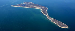
Plum Island, an 843-acre, federally-owned island off the tip of Long Island’s North Fork, has been proposed for sale by the federal government. In addition to historical importance, Plum Island has great ecological and environmental significance. It contains the largest seal haul-out site in southern New England and provides habitat to 216 migratory, overwintering, and breeding birds (one-fourth the North American total of avifauna).

Coyotes
Coyotes Coyotes on Long Island: Background The following videos, from presentations made by Gotham Coyote founders Mark Weckel and Chris Nagy at the 2015 Long Island Natural History Conference, (while already slightly outdated) provide excellent background about how coyotes arrived in our
Surveys & Consulting
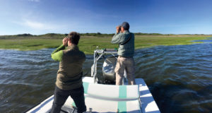
Good conservation begins with good science. A thorough understanding of both historical and existing ecological conditions is essential to ensuring that decisions regarding conservation policy initiatives and land management are effective and successful.